An Important Anniversary
2015 marks the hundreth anniversary of Italy’s entry in the First World War.
Time has passed. None of those who fought what has been defined the first modern warfare conflict on a worldwide scale is still of this earth. They no longer can turn, with their words and memories, those days and years into living images for us all.
The mountains, however, never die. The mountains stand silent and majestic, still bearing within the blue of their lakes, the white of their ice and the silver of their granite every single instant of those 4 years of tragedy. There is no battle the mountains have not witnessed, there is no soldier the mountains have not cradled in their motherly arms while in pain and sorrow, no tear they have not held in the palm of their stony hands.
The itineraries we propose below are of immense historical interest and span through the Italian regions (Veneto, Trentino Alto Adige and Friuli Venezia Giulia) through which the Eastern Front ran. These are roads winding through some of the most beautiful areas of the Bel Paese, touching upon the main peaks of the Dolomites, entering some of our most characteristic towns and villages. But above all, these are roads of remembrance.
Veneto
La Strada delle 52 Gallerie (the 52 Galleries road)
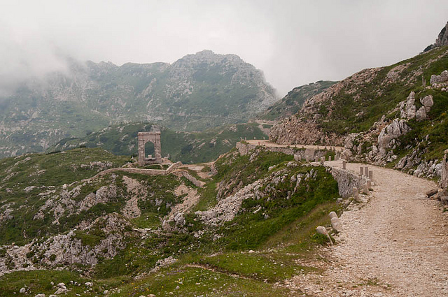
Also known as Strada della Prima Armata, it joins Bocchetta Campiglia to the Porte del Pasubio (1935 mt/6348 ft). It is denoted by the official CAI marking no. 366.
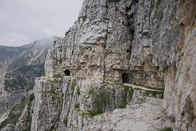
It was created to deliver supplies to soldiers stationed on the Monte Pasubio, while hiding from the enemy’s eye. The natural, geological conformation of the mountains in this area did permit to the road’s creators to do just so, as at least a third of the whole itinerary runs within the mountain’s belly, a characteristic from which the road takes its name.
The Strada is very popular among locals and Italian tourists and can be walked in its entirety in about 2 1/2 – 3 hours. The itinerary proper starts at Bocchetta Campiglia, where a relatively large parking lot is available; however, it tends to be always very crowded, so you may prefer to park at the Passo di Xomo, and reach Bocchetta Campiglia from there.
This is not a simple itinerary: the road is clean and clear, but narrow and impervious in places. The galleries are dark, so a torch is indispensable to walk through them in safety; also refrain from taking secondary galleries, which often branch out the main, as most of them are not in top-notch conditions and may be dangerous. This said, if you keep on the main route and thread carefully, you will be golden.
The Strada delle 52 Gallerie is a beautiful, rewarding experience for trekking lovers, but especially for all history buffs out there, who would have the opportunity to walk through a real piece of World War One memory. The path, which is incidentally a mule road much like those constructed by the Alpini in the Alpi Marittime, ends at the Rifugio Achille Papa. From here, you can either continue up to the Cima Palon, or return to the Bocchetta Campiglia and Passo Xomo through the Strada degli Scarubbi, on the north face of Mount Pasubio. Going back via the Strada delle 52 Gallerie is not recommended, as it’s quite dangerous. You can take the Strada degli Scarubbi that goes back to Bocchetta Campiglia and Passo Xomo.
The Strada delle 52 Gallerie meets other two paths of historical interest, the Sentiero degli Eroi and the Sentiero della Pace. One last note: biking on the Strada is not permitted for safety reasons.
La Strada degli Eroi
The Strada degli Eroi (the road of heroes) was built a handful of years after the end of the First World War, but it is profoundly tied to it.
It was ideated as a way to make the apex of Mount Pasubio more easily accessible. This was necessary since the area had been declared Sacra alla Patria (sacred to the Motherland), after the events of the First World War. The road in itself is only about 2 km long and joins the Galleria d’Havet to the Rifugio Achille Papa, near the Porte del Pasubio. It takes its name from the presence, on the rocky walls along its course, of memorial plaques for 15 First World War soldiers who received the Medaglia d’Oro al Valore Militare for their courage and effort on the Monte Pasubio.
Because the road connects with others, leading to interesting natural and historical locations, the name “Strada degli Eroi” has been somehow extended to the whole circuit of itineraries departing from and surrounding the road proper. The full itinerary connects the Achille Papa to the Pian delle Fugazze and is part of the Sentiero Europeo E5, as well as the Sentiero della Pace. The whole path covers a 10.6 km distance, and comprises almost exclusively of dirt roads. Car access has been closed since the 1980s, however, the Sentiero degli Eroi has gained great popularity among trekking and biking lovers, who enjoy it for both its natural beauty and historical relevance.

Museo Marmolada della Grande Guerra
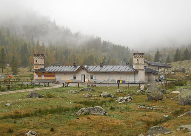
We are not strictly talking about an itinerary, but the initiative is of such interest and is located in such an outstanding location we could not neglect it. The museum, dedicated to the Great War, is annexed to the Funivia (cableway) della Marmolada‘s arrival station at Serauta, at 2950 metres above sea level (9678 ft). Its location is not outstanding only because of its altitude (this is the highest-set museum in the EU), but also because of its proximity to what used to be the Italo-Austrian front line.
The museum, which is entirely free to visit, has been conceived as a witness to the abominion and pain of war and collects within its rooms photos, documents and objects related to the people and the places of World War One. Of great interest is the reconstruction, in miniature, of course, of the Città di Ghiaccio (the City of Ice), an intricated series of trenches dug by soldiers into the ices of the Marmolada during the war. Many of the 800 finds kept in the museum have been unhearted there. The museum has just been renovated, so this Summer is a great moment to visit it.
The museum can be easily reached with the Marmolada Cableway from Malga Ciapela to Serauta, at 2950 metres. After the visit, if you wish, you can take the cableway once more to reach the peak of the Queen of the Dolomites (this is how we Italians call la Marmolada), at 3265 metres (10711 ft), then easily return to lovely Malga Ciapela, always by cableway.
Malga Ciapela is easily reacheable. If you come from a southern direction, take the Motorway Venezia-Belluno, then the SS 203 to Agordo, Alleghe, Rocca Pietore and Malga Ciapela. If you are coming from Milan, take the A4 motorway to Verona, then the A22 Brennero exiting at Ora-Egna. Here, follow the SS 48 “Delle Dolomiti” in direction Val Di Fiemme-Val di Fassa, Canazei, Passo Fedaia, Malga Ciapela. If you are travelling by train, go to Belluno, from where regular buses will lead you to Malga Ciapela. The closest airports are those of Treviso and Venice.
The village is well known among mountain lovers and skiers, so you will find plenty of B+Bs, hotels and Garnì to spend your nights.
Friuli Venezia Giulia
Itinerario del Monte Calvario e di Gorizia
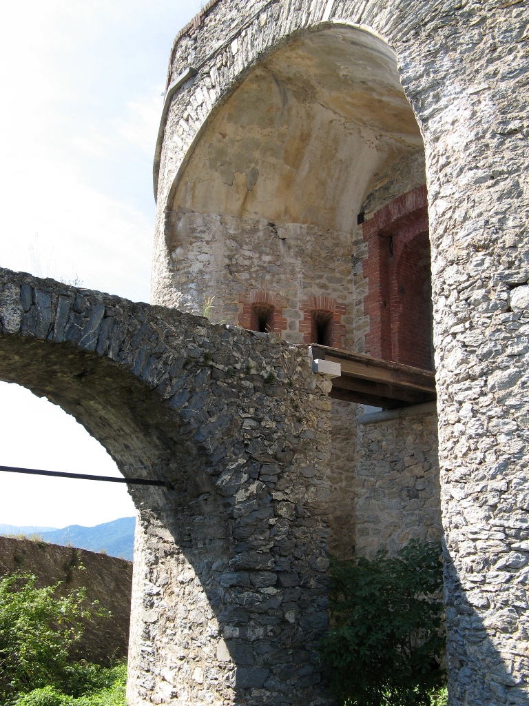
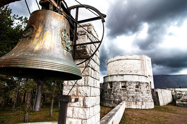
Gorizia remains one of the true symbols of the Italian effort during the First World War. A beautiful place to visit in its own right, the town became a theatre of tragic warfare starting from 1915: the Italian army needed to conquer it, but the Austrian-Hungarian defended it with nails and teeth for more than a year before finally capitulating. They managed to resist for such a long time also thanks to a series of strategic military installations, of which Monte Calvario is the most representative.
This itinerary is peculiar, because it touches upon areas and locations within the urban borders of Gorizia, before starting the ascent to the Monte Calvario, which rises at 240 metres above sea level. Of course, Monte Calvario is not a real mountain, but rather a mound, upon which a strategic defense post had been erected. The true heart of front line battles in the area, Monte Calvario no longer preserves any original remnants of those tragic years, but monuments have been erected in honor of those who fought. Of course, anyone with a certain sensitivity will not fail to feel powerful emotions in a place where so many tragically lost their lives.
The itinerary continues through the city and touches upon a long series of locations and monuments related to the Great War. If you are interested, you could also visit the Museo della Grande Guerra and the Sacrario Militare di Oslavia, both located in Gorizia.
Museo all’Aperto di Monte San Michele e San Martino del Carso
The Museo all’Aperto di Monte San Michele (an open air museum) is the starting point of a beautiful excursion among natural and historical sites of interest. It is an easy itinerary, ideal for the whole family, that touches upon several monuments dedicated to the Great War and its heroes, as well as actual locations once at the centre of military action and battles. The area was declared Zona Sacra alla Patria (just as Monte Pasubio) in 1922 and comprises of a series of interesting features; among them the Italian trench where for the first time, in 1916, chemical warfare was used on the Eastern Front, and the small borough of San Martino del Carso, brought to eternal fame by the verses of Giuseppe Ungaretti, ode to the tragedy of the conflict. All sites of interest are within walking distance from each other and form an outstanding memorial to the War, its history and its many victims.
Monte San Michele and San Martino del Carso are, today, quiet, tranquil, immersed in the beauty of the Carso.
The silence and peace of these places, however, surprisingly bring us back to the War and its deafening cry. This is probably the most outstanding among all the memories visitors will carry home from here, the barely conceivable juxtaposition between that which is now, and that which was 100 years ago to this day. More than a historical itinerary, more than a walk through the beauty of nature, a visit to the Museo all’Aperto di Monte San Michele and to San Martino del Carso means experiencing the past in the quiet silence it left behind, a silence louder, more powerful than a thousand voices.
Trentino Alto-Adige
Percorso di Guerra dalla Val di Ledro al Lago di Garda (Trentino Alto Adige)
This is a longer itinerary, divided in four days, retracing the military line on which the Italian and the Austrian-Hungarian armies fought. The line corresponds to what the border between the Kingdom of Italy and the Habsburg Empire used to be a century ago.
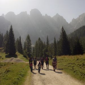
On the first day, the itinerary will lead you to the Rifugio Pernici, along the Bocca dell’Ussol ridge. Meeting point is the Rifugio Al Faggio, in the small borough of Al Faggio Lenzumo, near Ledro. The location is easily reached by train: the nearest station is in Rovereto, which is connected several times a day to Ledro and its surroundings.
During the walk, participants will have the opportunity to visit a suggestive military chapel, built within an Austrian mountain gallery. The whole itinerary of the day is part of the Sentiero della Pace (the road of peace) and, beside being of great historical interest, is also of immense natural beauty. It is considered a European Community Site of Interest for the peculiarity and uniqueness of its natural landscape.
On the second day, participants will leave the Rifugio Pernici in direction Riva del Garda, following path 413. The Austrian military hospitals of Saval are among the sites to visit along the way. If you are into proper mountaineering, you could reach the Cima Pari, which is also within the itinerary’s route and would offer outstanding views on the Lago di Garda, di Ledro and di Molveno. From here, you can then join path 413 back, and follow up a well preserved trench line. Before reaching Riva, a stop by the Cappella di Santa Barbara is a must: the view upon the town of Riva del Garda and the lake is outstanding.
The third day offers a pleasantly beautiful walk along the lake and its many Great War related sites. Once left the lakeside, the itinerary continues uphill to meet several forts and other relevant locations of historical interest. The fourth and last part of the itinerary departs from Nago-Torbole, a quaint village on the Lago di Garda in the Trento province. This section of the itinerary is more difficult: for this reason participants have the opportunity to take a shuttle bus to reach, following the Sentiero della Pace, the Rifugio Damiano Chiesa and the top of Monte Altissimo. Part of the route follows a 1915 path, cleaned up and made safe by the local Alpini association. The last leg of the walk will lead you to the Rifugio Damiano Chiesa. The whole route is characterized by the presence of numerous forts and barracks from the War. From the Damiano Chiesa, you will then return to Nago-Torbole: the village has its own train station, as well as regular bus services connecting it to the rest of the region, so traveling to another destination after the end of the four-day itinerary will not be an issue.
The itineraries proposed in this article are special: special because of the beautiful sceneries they are immersed into, of course, but even more so because of their historical and emotional meaning. More than a naturalistic walk, more than a history lesson, these itineraries truly put each and everyone of us in touch with a long gone past, but still close enough to bear signs upon the people of today.
Only a handful of years ago a friend of mine found out, while rummaging among her just-deceased grandmother’s documents, that her great grandfather, who went missing on the Eastern Front in 1917 and about whom her family had known nothing since then, had been, in fact, found and buried in Austria in the 1920s. Her great uncle, his son and only man in the family at the time, had decided to keep the pain of loss from his sister (my friend’s grandmother) and mother and let them believe he may have been still alive. She went to Austria a few months after the discovery, and was the first of her family to honor her great grandfather and lay a flower on his grave.
These men still touch our lives today, so. In spite of time passing and in spite of the world forgetting. Walking one of these itineraries is a good manner to remember them and honor them, all the while thanking we can today enjoy these lands of beauty in peace.